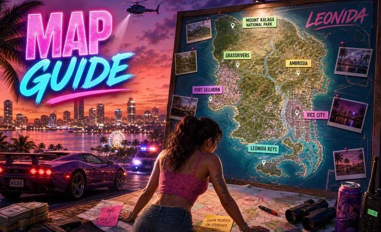
The GTA 6 map is one of the most searched parts of Grand Theft Auto VI, but Rockstar still has not published a complete labeled map of Leonida. What Rockstar has confirmed is the overall setting, the wider state structure, and six major destinations: Vice City, Leonida Keys, Grassrivers, Port Gellhorn, Ambrosia, and Mount Kalaga National Park.
Last updated: October 1, 2026. This page separates Rockstar-confirmed map information from community reconstructions, fan-made maps, and size estimates.
If you want a full breakdown of every confirmed place, also see our GTA 6 Locations guide. For world systems beyond geography, check our GTA 6 Gameplay guide.

Is There an Official GTA 6 Map?
No full official GTA 6 map has been released yet.
Rockstar has revealed a large amount of map-related information through:
- the main GTA VI website;
- the “Only in Leonida” people and places hub;
- official screenshots;
- Trailer 1, Trailer 2, and the Extended Look;
- edition and promotional materials that mention named places.
However, Rockstar has not published a complete map image with all roads, districts, borders, and labels.
What Rockstar Has Confirmed About the GTA 6 Map
| Map fact | Status |
|---|---|
| GTA VI takes place in Leonida | Confirmed |
| Vice City is part of the map | Confirmed |
| The story stretches across the state of Leonida | Confirmed |
| Six major destinations currently profiled by Rockstar | Confirmed |
| A complete labeled official map image exists publicly | Not confirmed / not released |
| Final square-mile or square-kilometer map size | Not officially published |
| Full road network and district boundaries | Not officially published |
The Six Confirmed GTA 6 Map Regions
| Region | Map role | What it adds to the world |
|---|---|---|
| Vice City | Urban core | Dense city streets, beaches, nightlife, commerce, port activity |
| Leonida Keys | Tropical island chain | Boats, coastal roads, bars, smuggling history, laid-back island life |
| Grassrivers | Wetland biome | Mangroves, shallow water, swamp travel, dangerous wildlife |
| Port Gellhorn | Run-down coastal town | Motels, empty strip malls, abandoned attractions, rough local economy |
| Ambrosia | Industrial and agricultural zone | Allied Crystal sugar refinery, rail infrastructure, biker influence |
| Mount Kalaga National Park | Northern wilderness | Forests, streams, hunting, fishing, off-road trails, backwoods |
This is the clearest official framework for understanding the GTA 6 map right now.
How the GTA 6 Map Differs From GTA 5
GTA VI is not just “Vice City again.”
Rockstar is positioning Leonida as a broader state-level world rather than a single city with surrounding countryside. That means the GTA 6 map appears designed around stronger contrasts between:
- dense urban districts;
- island and marine environments;
- wetlands and wildlife zones;
- declining coastal communities;
- industrial/agricultural inland areas;
- northern forests and off-road wilderness.
This multi-region identity is one of the biggest differences between the GTA 6 map and the more familiar structure of GTA V’s Los Santos and Blaine County.
Vice City on the GTA 6 Map
Vice City is the main urban anchor of the GTA 6 map.
Rockstar has already named several places inside or closely tied to Vice City, including:
- Ocean Beach;
- Little Cuba;
- Tisha-Wocka flea market;
- VC Port;
- Washington Beach;
- Southside Vice City;
- Stockyard;
- Watson Bay;
- Gambit Bay.
These names are important because they show that the GTA 6 map already has a deeper internal geography than just “Vice City” as one undivided blob.
Leonida Keys on the Map

The Leonida Keys expand the map far beyond city driving.
This region matters for map design because it suggests:
- separated islands;
- bridges and causeways;
- heavy water access;
- boat-focused exploration;
- smuggling routes;
- coastal safehouses and businesses.
It also appears closely connected to Jason’s early-life network, making it important both geographically and narratively.
Grassrivers, Port Gellhorn, Ambrosia and Mount Kalaga
The rest of the confirmed map gives Leonida a much wider environmental range.
| Region | Map identity | Likely gameplay value |
|---|---|---|
| Grassrivers | Swamps and mangroves | Wildlife, airboats, hidden routes, dangerous terrain |
| Port Gellhorn | Declining tourist coast | Roadside businesses, motels, derelict attractions, rough criminal activity |
| Ambrosia | Industrial sugar country | Refinery zones, freight routes, working-class settlements, biker territory |
| Mount Kalaga | Backwoods and national park | Hunting, fishing, ATV trails, off-road travel, isolated communities |
This variety is one reason the GTA 6 map has generated so much community analysis even before release.
Named Places Already Connected to the GTA 6 Map
| Place | What we know | Evidence level |
|---|---|---|
| Leonida Penitentiary | Prison where Lucia served time | Officially named |
| Ocean Beach | Vice City beachfront zone | Officially named |
| Little Cuba | Vice City neighborhood | Officially named |
| Tisha-Wocka flea market | Vice City retail area | Officially named |
| VC Port | Vice City port area | Officially named |
| Washington Beach | Named in 2026 edition material | Officially named in promotional material |
| Stockyard | Named in 2026 edition material | Officially named in promotional material |
| Southside Vice City | Named in 2026 edition material | Officially named in promotional material |
| Watson Bay | Named in 2026 edition material | Officially named in promotional material |
| Lake Leonida | Named in 2026 promotional material | Officially named in promotional material |
For a fuller place-by-place breakdown, visit our GTA 6 Locations page.
Official Map vs Fan Map vs Community Reconstruction
This is where many GTA 6 map articles become weak or misleading.
An official map and a community map are not the same thing.
| Type | What it means |
|---|---|
| Official map | Published directly by Rockstar |
| Fan map | A visual concept created by fans using trailers, screenshots, and real-world comparisons |
| Community reconstruction | A collaborative mapping effort that tries to estimate roads, coasts, and regions based on official media |
Community maps can be extremely useful, especially for visualizing Leonida before launch, but they should still be labeled as reconstructions rather than official Rockstar cartography.
How Big Is the GTA 6 Map?
Rockstar has not published the final official size of the GTA 6 map.
That means current claims about square miles, square kilometers, or “twice the size of GTA V” are still estimates, reconstructions, or community theories.
What is reasonable to say is that GTA VI appears designed around a broader state with stronger environmental diversity than previous GTA entries.
We recommend treating all exact size numbers with caution until Rockstar or the final game verifies them.
What an Interactive GTA 6 Map Should Eventually Include
This page can later evolve into a true map hub once the game launches.
| Future map layer | What it would track |
|---|---|
| Regions | Vice City, Keys, Grassrivers, Port Gellhorn, Ambrosia, Mount Kalaga |
| Districts & neighborhoods | Vice City sub-areas and named local zones |
| Missions | Main story and side-mission locations |
| Characters | Who is tied to each area |
| Vehicles | Vehicle spawns, marinas, garages, race zones |
| Weapons | Ammu-Nation locations, pickups, special unlocks |
| Businesses | Shops, safehouses, services, properties |
| Activities | Fishing, hunting, nightlife, races, off-road, boating |
| Collectibles | Map-based collectibles after release |
| Filters | Confirmed only / shown / community reconstruction |
That gives this page long-term value beyond being a one-time news post.
Best Way to Use This GTA 6 Map Page Right Now
- Use it as a map status page for official Rockstar information.
- Use it as a hub linking to locations, map size, gameplay, vehicles, and weapons.
- Use it to distinguish confirmed geography from fan speculation.
- Use it later as the base for an interactive GTA 6 map.
What Is Still Not Confirmed?
- The final official full map image.
- The complete road network.
- Exact region boundaries.
- The total number of cities and towns.
- The total number of Vice City neighborhoods.
- Final map size in square kilometers or square miles.
- Travel times between all major regions.
- The exact position of every named place.
- Every enterable building and business.
GTA 6 Map FAQ
Is there an official GTA 6 map?
Not yet. Rockstar has confirmed regions, scenery, and named places, but not released a fully labeled map image.
Where is GTA 6 set?
GTA VI takes place in the fictional state of Leonida, including Vice City and several surrounding regions.
Is Vice City the whole map?
No. Vice City is the main city, but the map also includes Leonida Keys, Grassrivers, Port Gellhorn, Ambrosia, and Mount Kalaga.
How many map regions are confirmed?
Rockstar currently profiles six major destinations.
How big is the GTA 6 map?
No official size figure has been published yet.
Are fan maps accurate?
Some community reconstructions are very detailed and useful, but they are still not official Rockstar maps.
Will there be an interactive GTA 6 map?
Rockstar has not announced one yet, but this topic is likely to become much more useful after launch as real in-game data becomes available.
When does GTA 6 release?
Rockstar currently lists GTA VI as coming on November 19, 2026.
Browse the rest of our GTA 6 guides hub for more verified GTA VI coverage.